Italian Study Combines Radar and Optical Satellites to Track Vineyard Growth in Oltrepò Pavese
Dual-technology approach offers new insights into vineyard structure, crop health, and climate adaptation for sustainable wine production
2025-09-09
Researchers in Italy have conducted a detailed study using both optical and radar satellite data to monitor vineyards in the Po Valley, focusing on how these technologies can track biomass changes and key growth stages throughout the season. The work, submitted in June 2025 by Andrea Bergamaschi and colleagues, is among the first to combine dual-polarimetric radar vegetation indices (DpRVI) with traditional optical indices for vineyard analysis.
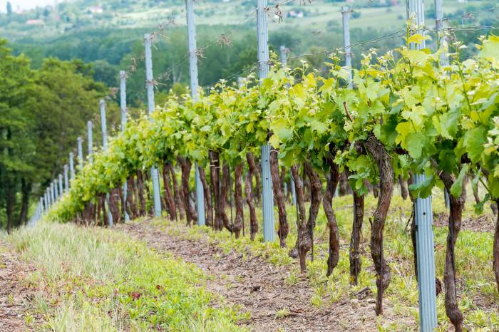
The study area is located near Santa Maria della Versa, in the Oltrepò Pavese hills of Lombardy, a region known for its extensive vineyards. The research team selected 12 vineyard parcels with either east-west or north-south row orientations to avoid geometric bias in radar data. These parcels were mapped using GIS and verified through ground surveys and high-resolution satellite imagery.
To capture the full growing season, the team used 12 Sentinel-1 radar images and six cloud-free Sentinel-2 optical images from March to August 2023. Sentinel-1 provides radar data that can be collected regardless of weather or sunlight, while Sentinel-2 offers multispectral optical data sensitive to plant health and structure. The radar data were processed using ESA’s SNAP software to generate DpRVI values, which reflect structural characteristics of the vines. Optical indices such as NDVI (Normalized Difference Vegetation Index), SVHI (Sentinel-2 Vegetation Health Index), and LAI (Leaf Area Index) were calculated from Sentinel-2 images.
The researchers compared the temporal evolution of DpRVI with optical indices across the growing season. Optical indices showed similar trends: low values in early spring, peaking around June, then declining as the season progressed. These indices are highly correlated because they are derived from similar spectral bands and primarily reflect leaf chlorophyll content and plant greenness.
In contrast, DpRVI values were more variable and did not show strong correlation with optical indices. This suggests that radar-based indices capture different aspects of vineyard structure, such as canopy geometry and water content, rather than just greenness. DpRVI trends appeared parabolic over the season, with peaks generally occurring between June and August depending on vineyard orientation and satellite pass direction.
To estimate biomass dynamics, the team used cumulative degree days (CDD), a measure of accumulated heat over time that is closely linked to vine growth rates. Biomass was estimated using established allometric equations that relate temperature accumulation to plant development. DpRVI values tracked these biomass estimates reasonably well, especially for ascending satellite passes, where average Pearson correlation coefficients reached 0.72 for east-west vineyards.
The study also examined whether precipitation influenced DpRVI values but found no clear relationship between rainfall events and radar index fluctuations during the observation period.
One notable finding is that DpRVI can help distinguish vineyards from other crops due to their unique row structures and scattering behavior in radar imagery. This capability could be valuable for regional crop mapping and monitoring.
The research aligns with broader efforts under Italy’s PNRR-NODES project to promote sustainable agriculture through nature-based solutions and advanced monitoring technologies. By integrating SAR (Synthetic Aperture Radar) with optical remote sensing, vineyard managers may gain more reliable tools for tracking crop health, predicting yields, and adapting to climate change impacts such as rising temperatures and shifting phenological stages.
The authors note that while their results are promising, further work is needed to refine these methods. Future studies could incorporate additional radar frequencies (such as X-band), use fully polarimetric SAR data for better discrimination of plant structures, apply advanced phenological models, and include ground-truth measurements like LIDAR or field sensors for validation.
This joint analysis demonstrates the potential of combining radar and optical satellite data for precision viticulture—a field that has grown rapidly since the late 1990s as growers seek more efficient ways to manage vineyards at a fine scale. As climate variability increases pressure on traditional wine regions like Oltrepò Pavese, remote sensing technologies may become essential tools for sustainable vineyard management across Europe’s major wine-producing countries.